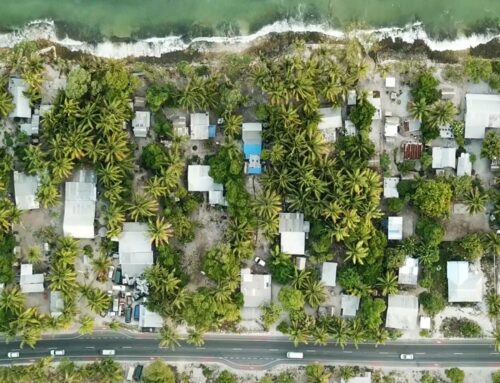
Think of a tropical island in the Pacific Ocean. What springs to mind?
Sunsets over endless horizons? Waving coconut palms and tropical fruit? Dolphins leaping into the air from crystal clear waters? Local fisherman in hand-carved canoes traversing a calm lagoon?
Ah, all those things. Oh and cyclones. And tsunamis, earthquakes, volcanoes, landslides, flash floods … and more cyclones.
I really do hate to spoil the romance but the beautiful countries that dot the Western Pacific really are among the highest risk in the world when it comes it natural disasters due to a cocktail of continental plate boundaries (which cause earthquakes) and a massive body of warm water (causing cyclones).
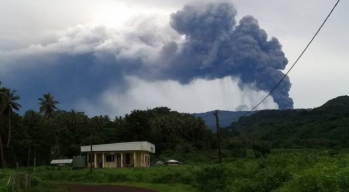
In the first three months of 2018 alone, the Pacific was hit by Cyclone Gita (striking Samoa, Tonga and southern Fiji), Cyclone Hola (striking Vanuatu), a continuation of volcanic eruptions on Ambae (Vanuatu) and a series of massive earthquakes in Papua New Guinea.
These natural disasters impact everything: houses, water supplies, roads and electricity systems, individuals, schools, government services … and — often more critically — health facilities.
In disaster response, getting information to the right people as quickly as possible is absolutely critical. This is where Tupaia is helping.
Tupaia provides a map pinpointing every health facility across ten countries in the Pacific
When a disaster strikes, local and international response and recovery teams mobilise to assess the damage. These teams aim to restore critical services as quickly as possible — particularly medical care.
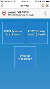
Pre and post disaster surveys in Tupaia MediTrak
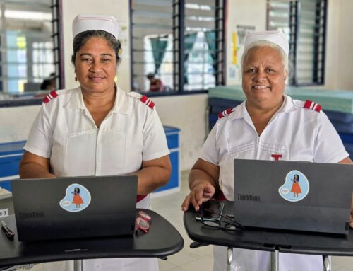
Tupaia is available to these response teams with a secure, online/offline data collection tool in Tupaia MediTrak, a free application for Android and iOS that can be used to assess and record damage. The app automatically pushes information to a data aggregation and visualisation platform that displays what medical services and facilities are available or affected. Information can also be aggregated in real-time from disease surveillance platforms or weather apps. Where the recovery effort is likely to be drawn out, Tupaia functions as an essential tool in establishing what interim services are needed to cover the gaps.
In a disaster, network connection is hardly reliable, so Tupaia MediTrak allows response teams and health staff to collect data offline, which will sync when the mobile device comes back into range. As soon as Tupaia syncs, the data is made available to local disaster response coordinators, donors and experts around the world. Responders can even take photos within Tupaia MediTrak, which are then displayed on the website, providing an accurate representation of the situation on the ground.
Tupaia provides a clear picture of disaster affected facilities
The disaster module at Tupaia.org presents an interactive map of health facilities, showing information about each facility, including their status in the wake of the disaster. Information can be viewed at the national level, the provincial level, and at the facility level, making it a useful tool for decision makers and responders at every level. Data is also secure, with powerful security features and the ability to grant permissions at a highly granular level so that different users need only access data relevant to them.
An example from the field: Tupaia surveys being conducted in difficult weather
After Cyclone Gita struck Tongatapu in Tonga in February 2018, Tupaia was used to assess all health facilities in the wake of the huge storm. Within 48 hours, data had been collected from all seven facilities on the affected island. This could immediately be compared with baseline data collected several months earlier, so response teams could see how measures of water, electricity and available services were impacted by the cyclone. The Tupaia app also allowed pharmacy staff to take photos of the damage, which could be compared with photos taken at the baseline stage.
Live dashboards were made available to the Ministry of Health and incoming response teams from Australia and New Zealand and they were able to use that information to quickly plan their response and direct resources.
What’s more, this process ultimately saved money. The rapid assessments showed the damage to health facilities was, in fact, minimal and that resources should be directed towards communities and other public infrastructure (including water supplies) that had suffered much worse damage.
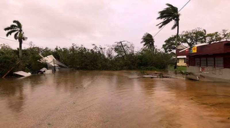
Tonga suffered widespread damage from Cyclone Gita in February 2018. Source: Reuters.
In Tonga, Tupaia helped maintain confidence in the health system and prevented an influx of unneeded medical teams and equipment. It might seem counterintuitive, but this certainly demonstrates that showing data on a lack of damage[1] can be just as valuable as showing the damage itself.
Unfortunately, the prevalence and intensity of a lot of natural disasters in the Pacific are set to worsen. For cyclones, this is as climate change accelerates and global sea temperatures rise. The impacts of landslides, earthquakes and tsunamis are also worsening, thanks to coastal erosion and deforestation in unstable, mountainous areas. More than ever, it’s crucial the region is prepared.
Here at Tupaia, we’re continually working to improve the disaster response capabilities to make sure that only the most relevant and meaningful data is being collected (in emergency situations, asking meaningless questions can cost valuable time). We are aware many people using tupaia.org post-disaster are accessing the website for the first time, so we are also working to make sure all maps and dashboards are clear and intuitive.
Check out tupaia.org and have a look for yourself. Cyclone Cyber is currently wreaking havoc on the fictitious country of Demo Land. While this is dreadful news for the equally fictitious inhabitants of Demo Land, it does provide a great chance for you to see the full disaster response functionality in action.
This resource is available to all Pacific Island countries for free. Let’s make the most of it for the benefit of the wonderful people who live there.
[1] Note: This is not to say that health facilities suffered no damage from Cyclone Gita but overall the buildings stood up to the Category 5 storm remarkably well — some smashed windows and minor water damage were noted, which could be appropriately triaged for when other issues had been addressed.